The Staveley/Brimington bypass has a history of its own. Now known as the Chesterfield to Staveley regeneration route we’ll highlight a little of its history in this blog. But this isn’t a full history by any means.
1920 – An arterial road
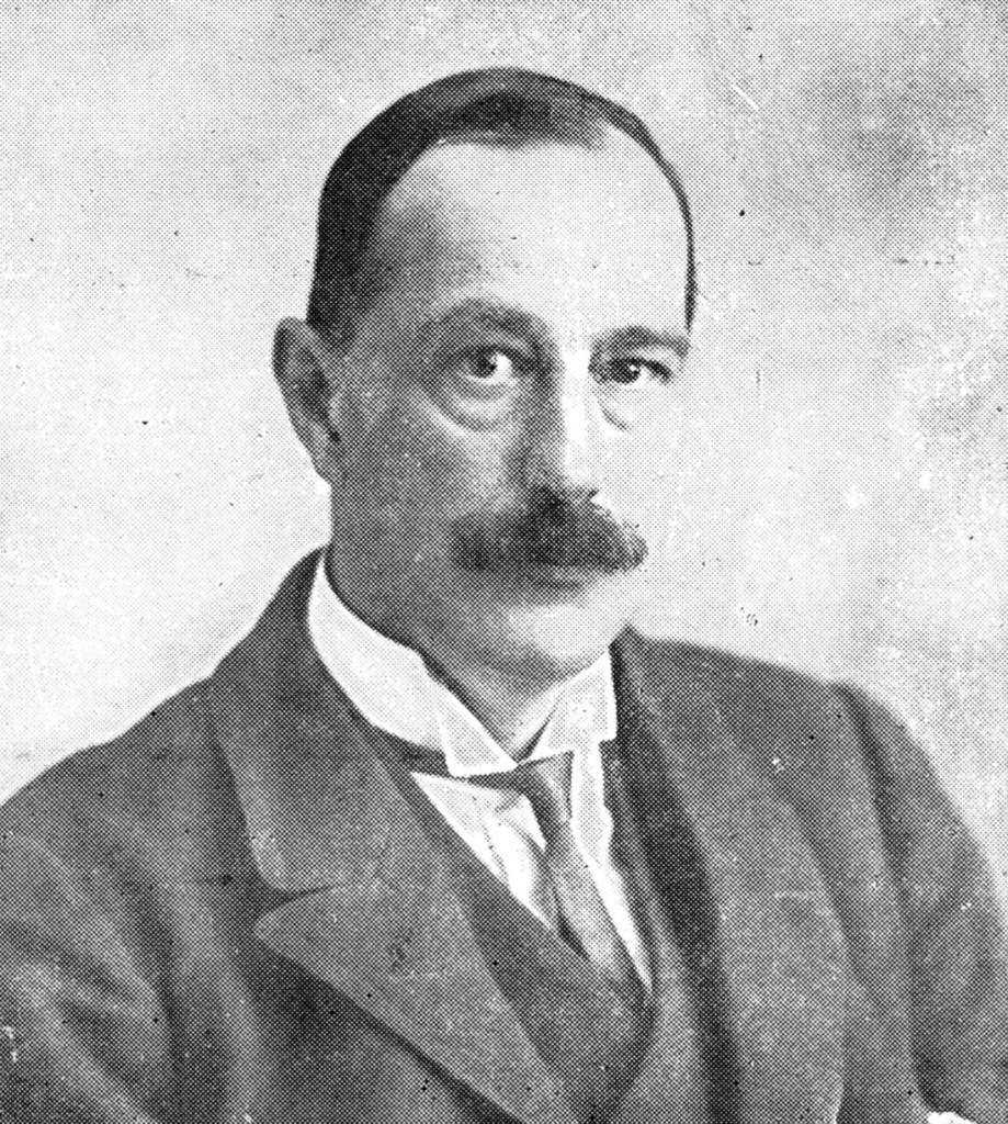
That once well-known industrialist and politician – Charles (Charlie) Paxton Markham (1865-1926), one time chairman and managing director of the Staveley Coal and Iron Company – regarded by some as ‘the uncrowned king of Chesterfield – appears to be the main originator of the bypass idea. His scheme for an ‘arterial road’ surfaces in the early 1920s.
In October 1921 local newspapers reported on a scheme to route a so-called arterial road on the bed of the disused Chesterfield Canal from Chesterfield to Norwood (although there would be some short departures from the canal route). Markham saw this as not only relieving traffic, but opening up land for industrial and housing development and providing employment. He had drawn together representatives from local authorities situated along the route. They generally agreed with the scheme. It was hoped the cost was to be borne by central government.
In fact moves towards an arterial road must have been preoccupying Markham for a period before 1921. In May 1920 a letter was tabled from him at both the Brimington Parish Council and Staveley Parish Council meetings about the subject.
By January 1922 the owners of the canal – the Great Central Railway – were said to be in general agreement of the canal’s replacement by this arterial road. The local authorities concerned were all agreed that the scheme should be submitted to the Ministry of Transport, with a delegation to follow.
The Chesterfield Canal Trust have a set of large scale Ordnance Survey maps, which we believe were probably prepared at Markham’s behest. They are annotated to show the arterial road’s route and give some sense of the engineering issues that might be encountered.
Further research is required to find out exactly what happened – but the scheme obviously did not go-ahead. (Markham died in 1926).
1927 and the Adshead report
By 1927 the arterial road had morphed somewhat and had been cut back, following road improvements on the route eastwards from Staveley. Never-the-less the Derbyshire Times of 17 July 1926 described the road suggested by Markham as ‘practically the nucleus of his [Adshead’s] new route’. Our illustration shows the revised route, still mostly on the bed of the canal. It’s taken from the 1927 ‘Adshead report’ as it became known. This was an official report to a joint planning committee titled ‘The Chesterfield Regional Planning Scheme’’. It was written by Professor SD Adshead, hence its name.
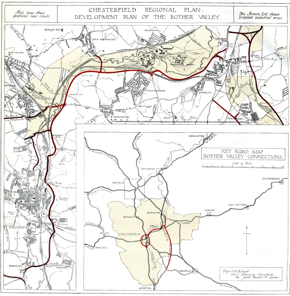
The report reviewed the current planning, development, industrial and physical constraints of the area and suggested some remedies. Included was construction of a ‘new valley road’. It was also suggested that the road should include a ‘large cast iron main from the river Rother, so as to supply water to ‘factories or works to be erected alongside’!
But this scheme, like the first was never built. Again, further work is needed to find out what happened, when and why.
The 1930s – a local bypass scheme
It is thought, though, that two short lengths of single carriageway bypasses for Brimington and Staveley were designed in the mid-1930s by the county council – but these never progressed either.
A 1949 ‘Survey of the Chesterfield Region’ was favouring a ‘qualitative improvement of the present road system rather than… an elaborate programme of new construction.’ Whilst Staveley was mentioned as being in need of a local bypass, Brimington was not.
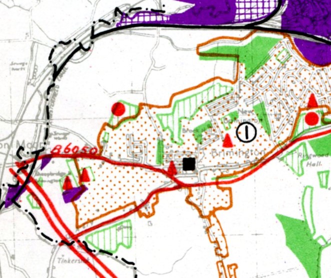
By the late 1950s policy had firmly swung against a canal route. The 1957 development plan for Staveley (together with part of the old Chesterfield Rural District area) indicated a local bypass situated in the central area of Brimington. This would have cut a route through the village slightly to the south of Hall Road and Ringwood Road. This may be the same scheme as that drawn up in the 1930s. Even in the 1960s this scheme was still being favoured. It appears in the town map (which sets out development priorities and land use) even as late as 1968, but this local scheme was superseded a year later.
1969 – a grander scheme again
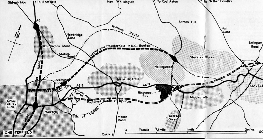
In 1969 the county council adopted a much grander scheme. This joined with Chesterfield Borough Council’ ‘s ‘cross valley link’ scheme at the Skull and Cross Bones Bridge, Tapton. The existing Brimington Road would have been widened with a new interchange on fields to the east of the lower end of that road, before the bypass would strike eastwards, crossing Manor Road where North Moor View is and then toward Ringwood Lake, which would be crossed on a viaduct. The whole scheme ended at Barlborough.
The 1970s and beyond
There was extensive and ultimately successful opposition to this so-called ‘preferred route’ – which we won’t go into here. Suffice to say that the county council cancelled a public inquiry into their route in 1974 and pledged to examine all available routes in greater depth.
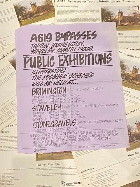
A new round of public consultations on the bypass were held in 1980 and again in 1995. Ultimately a much more agreeable route, following the Rother Valley, not far from the Chesterfield canal, but certainly not infilling it, was agreed.
Despite a detailed scheme being drawn-up in the 1990s funding was never forthcoming, but the Tapton bypass part of this revised scheme opened in April 1989. (There’s more about the Tapton bypass in our blog here).
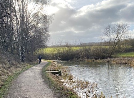
This is undoubtedly an over-simplification of this more recent period. There has also been a considerable amount of lobbying and campaigning during this time to try and ensure the bypass was constructed. Provision was also made for the bypass route during restoration of the Dixon Opencast Coal Site in the 1990s. The bed for the bypass can still be discerned just west from the Bilby Lane Canal Bridge, on the opposite side of the canal towpath.
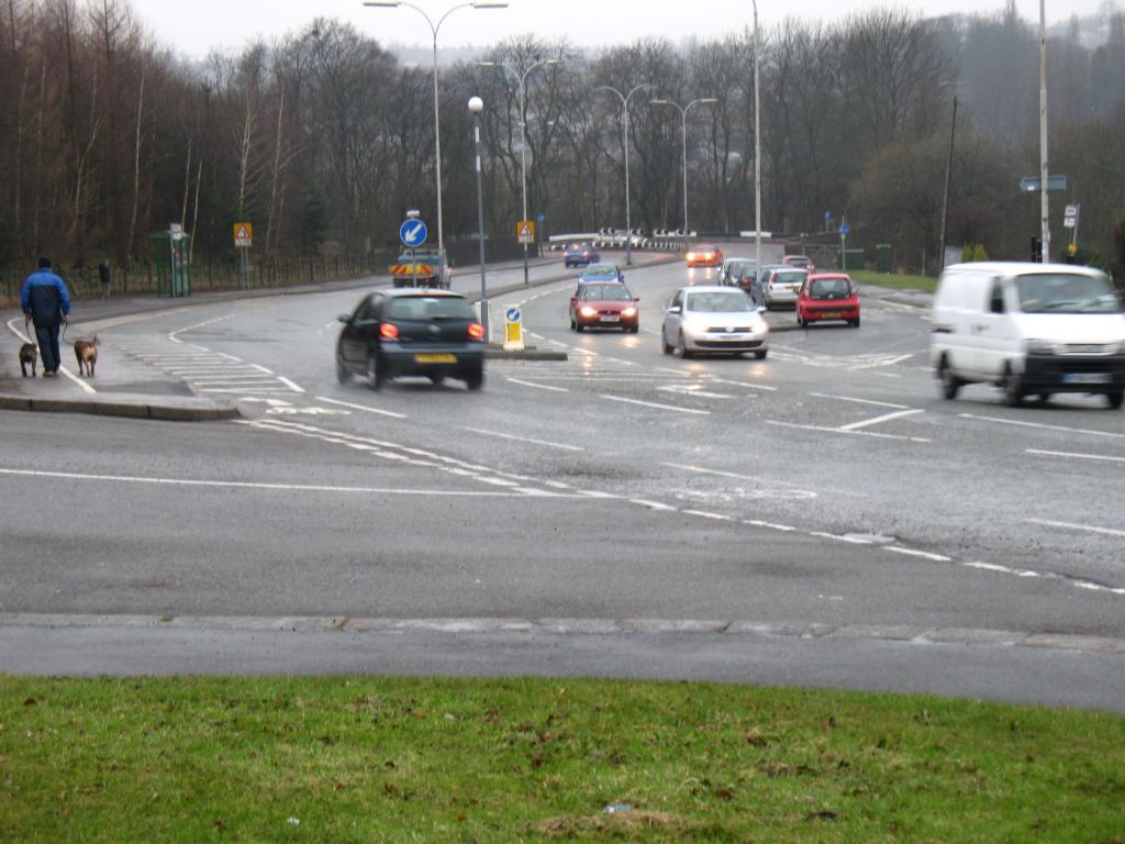
Now the former dual carriageway by-pass is to be single carriageway ‘regeneration route’, somewhat downgraded from Markham’s grand vision of an arterial road. Nor does it go as far as Barlborough, but thankfully it doesn’t involve infilling the Chesterfield canal.
Forgotten
There are a couple of now forgotten elements to the various bypass schemes, one of which has certainly been beneficial (unless you like industrial estates).
The ‘Cross-Valley Link’ is remembered in the late 1960s dual carriageway width bridge over the railway line at Tapton. This scheme was designed to link up with the Tapton end of the Brimington/Staveley by-pass. Onwards, it would have crossed the Rother valley, at least partially on a viaduct, to join up with a new Chesterfield inner relief road. The relief road may have been constructed, but the cross-valley link never progressed beyond the bridge.
Perhaps there is one important benefit as a result of the by-pass not having been built. The agreed 1980s route was to designed open up some 27 hectares of industrial land north of Brimington. This land is in the Bilby Lane and Cowpingle Lane area of the canal. If the by-pass had been built the 1985 Staveley/Brimington local plan allowed for the development of this industrial estate and the loss of part of the open space and fields we enjoy today in that area.
Some things do have a silver lining – even when an important route, discussed since at least 1921, has been delayed by over 100 years!
Sources used in this blog
- Brimington Parish Council minutes (11 May 1920) (in the Derbyshire Record Office, Matlock)
- SD Adshead, Chesterfield Regional Planning Scheme (1927).
- Chesterfield Borough Council Staveley/Brimington Local Plan (1985).
- Chesterfield Rural District Council (RDC), Diversion A619. A study of the proposals for the diversion of the A619… (1972).
- Derbyshire County Council (DCC), Development plan for the county, town map for Staveley and part of the rural district of Chesterfield 1957 (1957).
- DCC, Development plan for the county, town map for Staveley and part of the rural district of Chesterfield, amendment number 9 (1968).
- DCC, Staveley-Brimington by-pass (c. 1972).
- DCC, A619: bypasses for Tapton, Brimington and Staveley – public consultation (1980).
- DCC, Brimington-Staveley bypass public preview (leaflet) (1995).
- DCC, Chesterfield to Staveley regeneration route, public consultation [leaflet], March/April 2022 (2022).
- KC Edwards and FA Wells, Survey of the Chesterfield region (1949).
- Husband & Co. and St Ermin’s, Report for Chesterfield RDC, Chesterfield Borough Council and Staveley Urban District Council, Brimington/Staveley bypass alternative route, preliminary report stage II, March 1974 (1974).
- Derbyshire Courier 15 May 1920, 29 October 1921.
- Derbyshire Times, 29 October 1921, 28 January 1922, 17 July 1926.
- Derbyshire Life and Countryside, November 1968.
This account was edited on 16 July 2023 adding reference to pre-1921 correspondence from CP Markham to the parish council’s of Brimington and Staveley.
